1) Overview
Tour Du Mount Blanc is a ~170 km / 105 mi hut-to-hut circuit around the Mont Blanc massif through France, Italy, and Switzerland. Start/finish wherever is convenient, but this guide follows a classic 10-day, Les Houches → Les Houches loop. No trail permit is required; you book accommodation night-by-night. The official portal centralizes bookings and practical info (montourdumontblanc.com)
When to go: Late June–mid-September (shoulder months can hold snow; many huts close outside summer). Book beds well ahead in July–August, and avoid UTMB race week when valley lodging and transport sell out (2026 UTMB events run August 24–30, 2026).
How this article is organized:
We’ll go stage by stage in 10 days from Les Houches to Les Houches, and flag where you can trim to 7–8 days or stretch to 11–12. Before that: packing and arrival logistics. After the stages: an all-in cost summary, tips, and final thoughts.
2) What to pack (Hut-to-Hut)
Target pack weight: 6–10 kg (13–22 lb) without water for hut-to-hut. You don’t need a full sleeping bag in summer—bring a sleeping-bag liner, which many refuges require (and they provide duvets/blankets).
Essentials
- Documents & money: Passport, insurance with mountain rescue, debit/credit + small cash (EUR + CHF).
- Navigation & comms: Phone with offline maps (IGN/Swisstopo), battery bank, whistle; 112 works EU-wide.
- Footwear: Trail runners or light boots (well broken-in) + blister kit; poles strongly recommended on long descents.
- Clothing (carry 3–4 days): Waterproof jacket & rain pants; warm midlayer (fleece or light puffy); quick-dry base layers x2–3; hiking pants/shorts; sun hat/beanie; light gloves.
- Sleep & hut kit: Liner, earplugs, eye mask, compact towel & toiletries (tiny bottles), headlamp.
- Hydration & food: 1–2 L capacity; water treatment (most sources good, treat if unsure); snacks for between huts.
- Seasonal add-ons: Microspikes (very early/late season snow), gaiters, swimsuit (spa/lake), light sun hoody.

Popular, reliable picks (examples only, pick your favorites):
- Trail runners (Salomon, HOKA, Altra)
- 25–35 L pack (Osprey, Deuter, Gregory)
- 3-layer shell (Rab/Arc’teryx/Patagonia)
- Trekking poles (Black Diamond/Leki)
- Liner (Sea to Summit silk or Coolmax).
3) Arrival & starting points
Most common start: Les Houches (Chamonix valley, France). Fly into Geneva (GVA) and take a shared shuttle to Les Houches/Chamonix from ~€19.50 (AlpyBus) or similar with other operators. Trains and local buses also serve the valley.
Other practical starting/ending hubs
- Courmayeur (Italy): Bus through the Mont-Blanc Tunnel connects Courmayeur ↔ Chamonix/Les Houches; seasonal variations apply—check Arriva/SAVDA. Great if you want Italian cuisine and easy Rifugio access on nights 3–5.
- Champex-Lac or Trient/Col de la Forclaz (Switzerland): Reach via SBB train to Martigny then PostBus up the valley (routes to Champex-Lac/La Fouly/Trient run in season).
Permits & paperwork
- No trail permit. Your “permit” is simply each hut/gîte booking; the official TMB portal aggregates many refuges and provides practical rules.
- Bivouac/wild camping is restricted (timing/altitude/distance rules) and varies by commune/country—read and obey local guidance. Fines are real.
Luggage services
- If you want to hike light, bag-to-bag transfer companies will move one duffel a day between your booked lodgings (typical single-day quotes ~€30–€35/bag; multi-day circuits available; advance booking recommended).
Arrival day pro-moves
- Drop by the Les Houches/Chamonix tourist office for last-minute bus timetables and lift status; note Bellevue/Prarion hours if you plan to shortcut day 1 or day 10. Bellevue summer 2025 adult RT €23.50; check daily opening times.
4) Stage-by-stage (10 days, Les Houches → Les Houches)
Stage 1: Les Houches → Les Contamines
Distance: ~18 km / 11 miles
Time: 5–6 hours
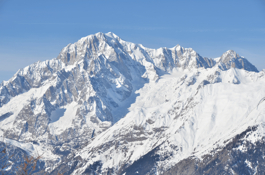
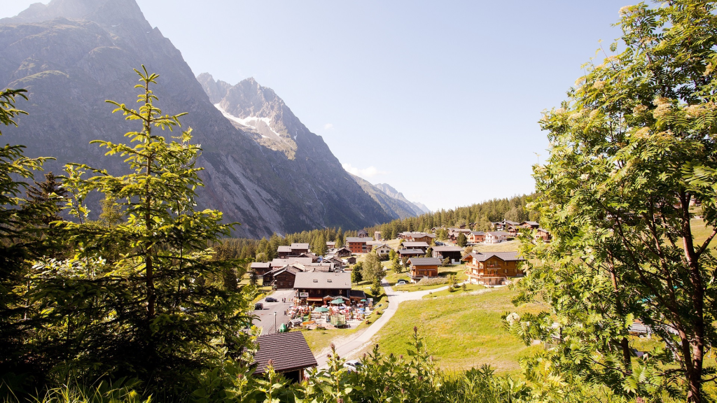
Your journey begins in Les Houches, a friendly alpine town just a short ride from Chamonix. The trail wastes no time introducing you to the Mont Blanc region, climbing steeply to the Col de Voza. Here you’ll have your first sweeping views of the Mont Blanc massif and the Bionnassay Glacier. Many hikers opt for the Col de Tricot variant, which crosses a thrilling suspension bridge and offers unforgettable glacier views before dropping into the pastoral Miage Valley. Expect to pass working farms where you can pause for fresh cheese and local fare.
Trail Markings: Look for the red-and-white striped GR-TMB markers and yellow French hiking signs. Navigation is straightforward, but the Col de Tricot detour is less clearly marked—watch for signs just beyond Col de Voza.
Where to Stay:
- Les Contamines: A traditional Savoyard village with multiple options. Gîte la Barmaz (rustic dormitory with hearty meals) and Hotel La Chemenaz (cozy, more upscale with spa access) are standouts.
- If you take the longer Col de Tricot variant, consider staying at Refuge de Miage, perched in a stunning valley with glacier views.
Resupply: Les Contamines has a supermarket, bakeries, gear shops, and a pharmacy, making it an excellent place to stock up before the high passes.
Extensions & Cuts: Add the Col de Tricot for the most scenic start; shorten by taking a cable car from Les Houches to Bellevue, skipping the first climb.
Stage 2: Les Contamines → Refuge des Mottets
Distance: ~24 km / 15 miles
Time: 7–9 hours
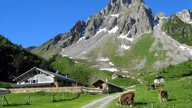
This is the first “big mountain day,” climbing steadily through forests, meadows, and eventually high alpine terrain. The highlight is the Col du Bonhomme (2,329 m / 7,641 ft), often snow-covered early in the season. After crossing this dramatic saddle, the trail ascends again to the Col de la Croix du Bonhomme, with panoramic views across the Beaufortain Alps. The descent to Refuge des Mottets is long but spectacular, following old Roman roads and shepherd trails.
Trail Markings: Still on GR-TMB red-and-white paint blazes; cairns help guide over the cols. Fog can roll in quickly—bring a GPS or map.

Where to Stay:
- Refuge des Mottets: A converted alpine dairy farm with warm dorms, private rooms, and legendary raclette dinners.
- Refuge de la Croix du Bonhomme (higher up): Remote, rustic, and exposed to the elements—a true mountain refuge experience.
Resupply: Minimal—carry snacks. Refuge des Mottets offers packed lunches.
Extensions & Cuts: Hardcore hikers can push from Les Contamines straight to Courmayeur in two long days, but most savor this section. Shorten by staying at Croix du Bonhomme refuge.
Stage 3: Refuge des Mottets → Courmayeur (Italy)
Distance: ~23 km / 14 miles
Time: 7–8 hours
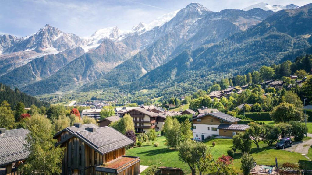
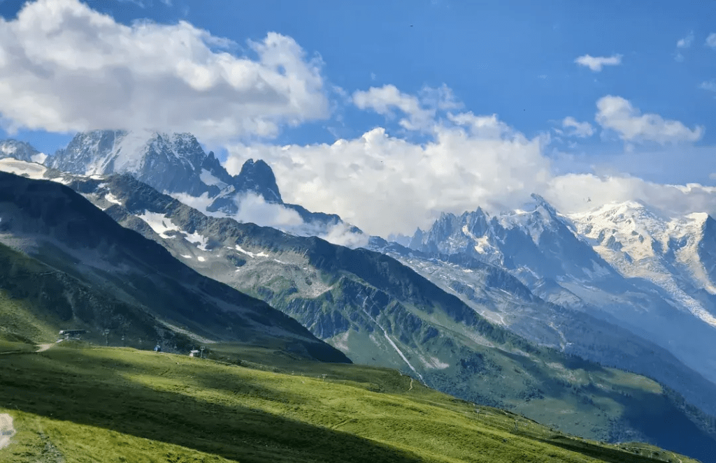
Today’s reward is crossing into Italy via the stunning Col de la Seigne (2,516 m / 8,255 ft). The view of the Italian side of the Mont Blanc massif is jaw-dropping, with glaciers spilling down sheer granite walls. From the col, the descent into the Val Veny is wide and dramatic, dotted with alpine flowers and grazing marmots. Passing the Lac Combal, you’ll eventually descend into the lively Italian town of Courmayeur, known for its cobbled streets, gelato, and excellent dining.
Trail Markings: French markers give way to Italian signs (yellow paint, TMB waymarks). Clear and well-traveled.
Where to Stay:
- Courmayeur: Endless options, from family-run guesthouses to luxury hotels. Popular: Hotel Crampon (budget-friendly, central) and Hotel Berthod (classic alpine charm).
- For a quieter night, stop earlier at Rifugio Elisabetta, perched at 2,195 m with glacier views.
Resupply: Courmayeur is a major stop—supermarkets, outdoor shops, ATMs, and pharmacies.
Extensions & Cuts: Some skip Courmayeur and continue to Rifugio Bertone, but most hikers enjoy a rest day here for food and culture.
Stage 4: Courmayeur → Rifugio Bonatti
Distance: ~12 km / 7.5 miles
Time: 4–5 hours
One of the most beautiful stages of the TMB. After a steep ascent to Rifugio Bertone, the trail follows a high balcony path overlooking the southern face of Mont Blanc. Expect constant glacier views, deep valleys, and unforgettable ridgelines. The day ends at Rifugio Bonatti, a modern, comfortable hut with one of the best sunset terraces on the route.
Trail Markings: Well marked but can be confusing around the initial ascent from Courmayeur—watch for switchbacks.

Where to Stay:
- Rifugio Bonatti: Bright, airy dorms and excellent food. Known for a lively atmosphere and incredible views.
- Alternative: Rifugio Bertone (smaller, rustic, closer to Courmayeur).
Resupply: Limited—carry snacks. Rifugio Bonatti sells sandwiches, beer, and chocolate.
Extensions & Cuts: Many hikers choose to overnight in Courmayeur and then push all the way to Bonatti. A scenic variant via Mont de la Saxe is highly recommended for experienced hikers.
Stage 5: Rifugio Bonatti → La Fouly (Switzerland)
Distance: ~20 km / 12.5 miles
Time: 6–8 hours
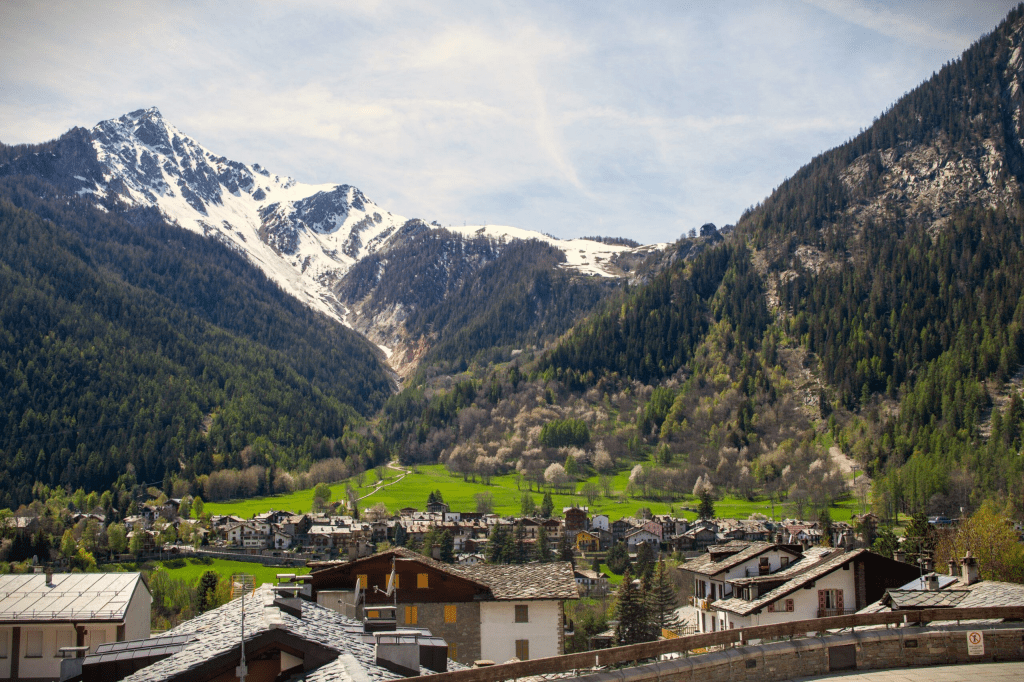
From Bonatti, the trail traverses rolling alpine meadows before climbing to the Grand Col Ferret (2,537 m / 8,323 ft), marking the border into Switzerland. Views of the Grandes Jorasses and Mont Dolent (where France, Italy, and Switzerland meet) are a highlight. The descent is long but scenic, leading into the pastoral Swiss village of La Fouly, where wooden chalets line the valley floor.
Trail Markings: Easy to follow; Swiss markers are white-red-white stripes with yellow signposts.
Where to Stay:
- Auberge des Glaciers (friendly guesthouse with hearty Swiss meals).
- Camping des Glaciers for budget travelers.
Resupply: La Fouly has a small grocery, ATM, and bakery—good for snacks but not full resupply.
Extensions & Cuts: Hardcore hikers can push to Champex, but La Fouly is a restful and scenic stop.
Stage 6: La Fouly → Champex-Lac
Distance: ~15 km / 9 miles
Time: 5–6 hours
This stage is gentler, following the river through alpine pastures and forested valleys. Traditional Swiss hamlets like Praz de Fort and Issert showcase classic wooden chalets with flower boxes. The trail finishes with a steep but short climb into Champex-Lac, a lakeside resort town nicknamed “Little Canada” for its pine forests and clear mountain lake.
Trail Markings: Yellow Swiss signposts and white-red-white blazes.
Where to Stay:
- Hotel du Glacier (mid-range, central, excellent restaurant).
- Relais d’Arpette (rustic and budget-friendly).
Resupply: Champex has a grocery, gear store, and several restaurants.
Extensions & Cuts: Options to continue via the Fenêtre d’Arpette the next day (challenging but spectacular).
Stage 7: Champex-Lac → Trient
Distance: ~15 km / 9 miles
Time: 6–7 hours
Leaving Champex, the trail climbs steadily through forest to the Bovine Route, a traditional herding trail with open views of the Rhone Valley. Cows with bells line the meadows, and chalet cafés offer fresh milk and rösti. The descent into Trient is steep and wooded, with the pink church of the village a welcome landmark.
Trail Markings: Clear, but the forested descent can be slippery after rain.
Where to Stay:
- Auberge Mont Blanc (simple dorms, lively communal dinners).
- Relais du Mont Blanc (family-run, quieter atmosphere).
Resupply: Very limited—carry snacks.
Extensions & Cuts: Strong hikers can attempt the Fenêtre d’Arpette variant, a high alpine pass with scree and snowfields.
Stage 8: Trient → Argentière (France)
Distance: ~17 km / 10.5 miles
Time: 6–7 hours
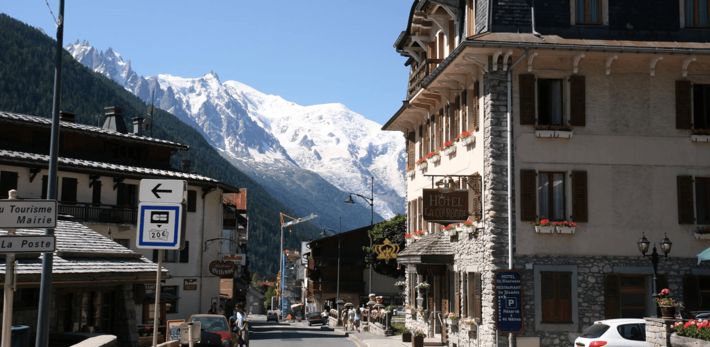
The trail climbs again to the Col de Balme (2,191 m), crossing back into France with wide-open views of the Mont Blanc massif. Weather permitting, this is one of the most photogenic points of the trek. From the col, the descent leads to Argentière, a lively ski town with plenty of services and a true alpine vibe.
Trail Markings: French GR signs reappear; well marked.
Where to Stay:
- Hotel de la Couronne (historic, central).
- Camping du Glacier d’Argentière (budget-friendly).
Resupply: Argentière has supermarkets, bakeries, and gear shops.
Extensions & Cuts: Variants via Aiguillette des Posettes offer more ridge walking and views.
Stage 9: Argentière → La Flégère
Distance: ~14 km / 8.5 miles
Time: 5–6 hours
This stage is all about balcony trails overlooking Mont Blanc. The climb to Lac Blanc is steep but rewarding, with a famous alpine lake reflecting the peaks above. Wildlife is common here—ibex and marmots often spotted. The trail continues to La Flégère, a ski station with dramatic panoramas.
Trail Markings: Clear but rocky around Lac Blanc. Popular, so expect crowds.
Where to Stay:
- Refuge de La Flégère (basic but right on the balcony trail).
- Refuge du Lac Blanc (scenic, rustic, extremely popular—book early).
Resupply: None—carry food.
Extensions & Cuts: Can skip by taking the cable car from Argentière to La Flégère.
Stage 10: La Flégère → Les Houches
Distance: ~20 km / 12.5 miles
Time: 6–8 hours
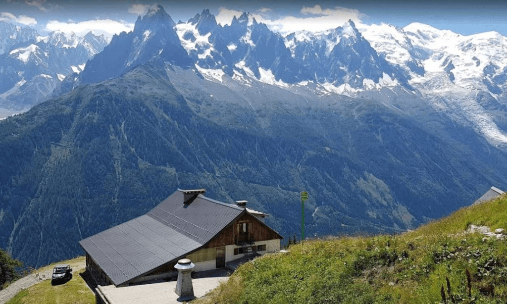
The final stage is a spectacular finish. Traversing the Grand Balcon Sud, hikers enjoy unmatched views of Mont Blanc. The trail climbs over the Brévent (2,525 m), often considered the best panoramic viewpoint of the trek. The descent into Les Houches is long and knee-testing but satisfying, ending where the circuit began.
Trail Markings: Clear; multiple descent routes to Les Houches.
Where to Stay:
- Back in Les Houches, celebrate with dinner at a local Savoyard restaurant or relax at Hotel du Bois (pool, sauna).
Resupply: Full services available back in Les Houches/Chamonix Valley.
Extensions & Cuts: Some hikers overnight at Brévent or Flégère to catch the sunrise. Cable cars can shorten the descent.
5) Costs & Booking — What It Really Adds Up To
Hiking the Tour du Mont Blanc can be done on a shoestring budget, in moderate comfort, or with a bit of alpine luxury. Because each stage varies (town vs. hut), we’ve listed daily average costs by travel style and then summarized what this looks like across the full trek.
Per-Day Cost Breakdown
| Style | Lodging | Meals | Extras (transport, snacks, showers) | Daily Total |
|---|---|---|---|---|
| Budget (camping / simple dorms) | €15–35 | €15–20 | €5–10 | €40–65 |
| Mid-Range (refuges / gîtes half-board) | €50–70 | included in half-board | €10–15 | €60–85 |
| High-End (private rooms / hotels) | €80–150 | €25–50 | €20+ | €125–200 |
Total Trip Costs (10–12 days)
| Travel Style | 10 Days | 11 Days | 12 Days |
|---|---|---|---|
| Budget | €400–650 | €450–750 | €500–800 |
| Mid-Range | €600–850 | €650–950 | €700–1,050 |
| High-End | €1,250–2,000 | €1,350–2,200 | €1,500–2,400 |
Note: flights, insurance, and gear not included.
Booking: How to Secure Your Spot
- Refuges & Huts → Book directly on Refuges.info or on each hut’s own website (many open bookings in December–January for the following summer).
- Gîtes & Auberges → Common in towns (Les Contamines, Courmayeur, Champex). Reserve via their websites or on Booking.com.
- Hotels → Available in Chamonix, Les Houches, Courmayeur, Champex, and Chamonix Valley towns. Best to book 6–9 months in advance in high season.
- Luggage Transfer → Services like Taxi Besson and AlpyBus carry your bag between stages (€30–50 per bag per stage).
- Tours & Packages → For hikers who prefer logistics handled, companies like Macs Adventure, Alpenwild, or UTracks offer guided and self-guided packages.
6) Tips that save time, money, and headaches
- Book beds first, then fill the gaps. Lock the “hard” nights (Bonatti, Mottets/Elisabetta, Arpette) and route around them. Use the official portal map to spot availability.
- Check lift hours & weather daily. Lift schedules change by date, and afternoon storms are common—re-check the morning of.
- Mind the bivouac rules. Bivouac ≠ wild camping. It’s narrowly defined and policed; sleep in huts/gîtes if you’re unsure.
- Pick variants by conditions. Save Fenêtre d’Arpette for stable weather; take Bovine if it’s stormy/low-viz.
- Carry a liner. It’s lighter than a sleeping bag and required at many huts; duvets/blankets provided.
- Race week alert. UTMB packs the valley; book far in advance or choose other weeks.
- Emergencies: Dial 112 anywhere in the EU (routes cross borders often)
7) Final thoughts
If you like your hikes rich—three countries, constant big-mountain views, real food in real refuges, and just enough challenge to feel earned—the TMB is hard to beat. Nail the beds, watch the weather, carry the liner, and build your days around a few smart shortcuts (or glorious variants) and you’ll have a smooth, spectacular loop.

Leave a comment