

Trailside VitalsExplore
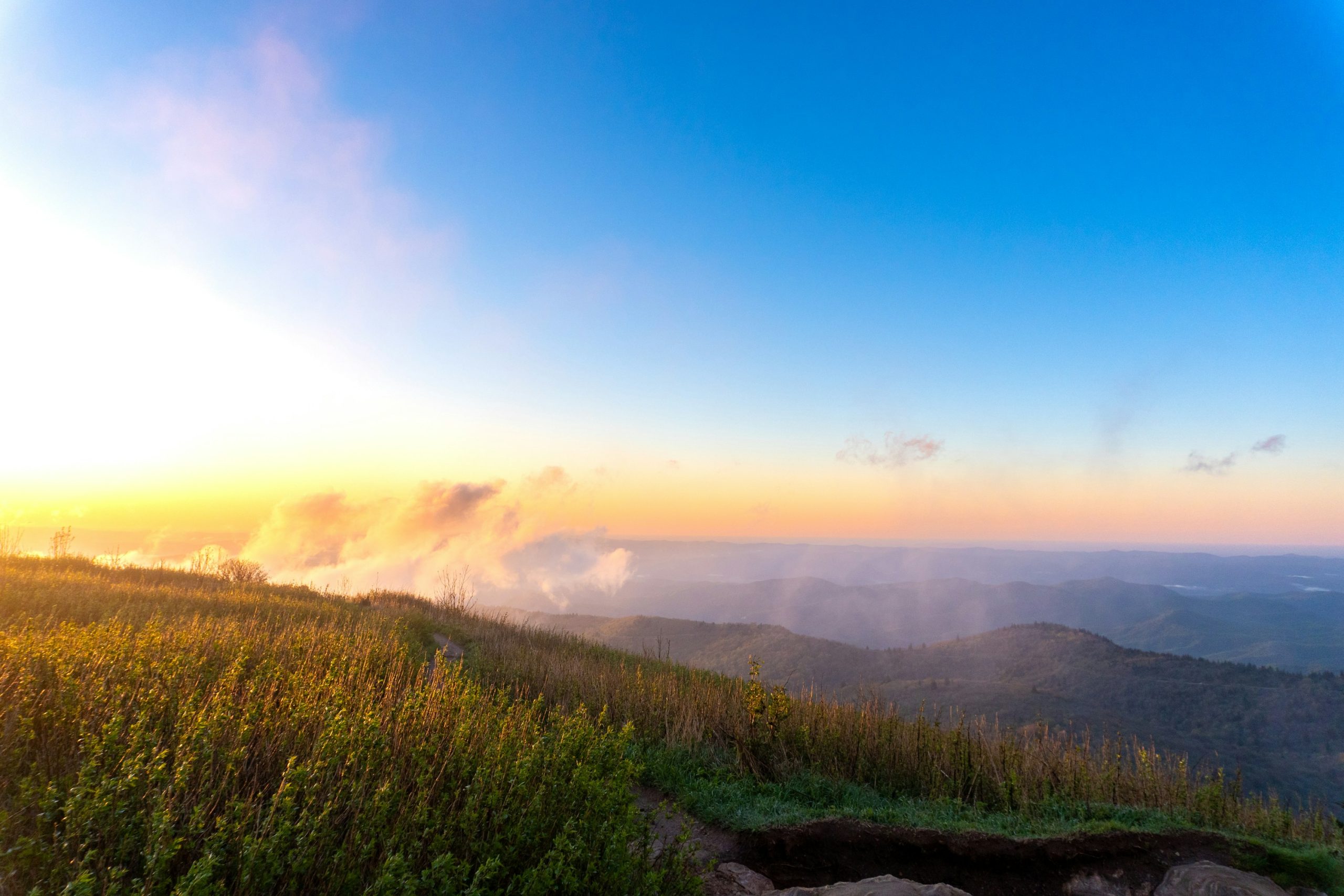
Sunrise lights a grassy slope and misty mountain ridges at Black Balsam Knob.

Art Loeb Trail

Location: North Carolina

Backpack from Davidson River through the Black Balsam highlands and Shining Rock Wilderness to Camp Daniel Boone.

Essential facts

Challenge
Hard
Planning duration
3–4 days
Route distance
29.4 mi GPX-derived horizontal estimate (not official). Variant: Art Loeb Trail | Full trip | Planning.

Overview

The Art Loeb National Recreation Trail crosses the Pisgah Ranger District through a chain of ridges, gaps and high-elevation balds.

Climb from Davidson River past ridge viewpoints and Butter Gap Shelter. Continue over Pilot Mountain and Deep Gap, then cross the Black Balsam / Tennent Mountain high country into Shining Rock Wilderness. The Forest Service identifies the high-country section as 6.8 miles and Difficult, with cold, rainy weather possible much of the year.

At Ivestor Gap the trail enters or follows the edge of Shining Rock Wilderness; Forest Service signage warns that the wilderness portion has no blazes or signs, so map-and-compass navigation is needed. Plan the whole traverse around steep climbs, limited trail markings and the weight of an overnight pack. The land manager grades each segment Difficult.

At a glance

Cost & booking summary
Plan 3–4 days northbound, with Butter Gap Shelter and southern Deep Gap Shelter as overnight stops. Arrange point-to-point transport; Pura Vida lists $160 for one, $170 for two, or $62/person for 3+.

See dated prices & planning options

Before you book or set out

  • Wilderness: Overnight Shining Rock travel requires a compliant solid bear-resistant canister. Groups are limited to ten and wood fires are prohibited.
  • Navigation: Wilderness sections have no blazes or signs. Carry and know how to use a map and compass; prepare for cold, wet ridge exposure and treat natural water.
  • Access: Arrange a point-to-point transfer. Gloucester Gap is an intermediate access, not the northern finish; overnight parking there is not recommended by the Forest Service.
Route alternatives, season & research details

Route/experience variants and season

  • Full northbound traverse: start at the Davidson River trailhead and follow the Art Loeb corridor through its four Forest Service-described sections toward the northern terminus near Camp Daniel Boone. The official trailhead page warns that overnight parking is not recommended at Gloucester Gap, an intermediate access point; do not treat it as the full northern finish. A point-to-point shuttle or a separately planned vehicle arrangement is needed.
  • Section day hikes: the Forest Service lists section distances of 12.3, 7.2, 6.8 and 3.8 miles (30.1 miles combined). Section 1 climbs from the Davidson River area; section 3 includes Black Balsam and Tennent Mountain; section 4 is very steep and enters wilderness with no blazes. These are section totals, not a recommended 3–4-day mileage schedule.
  • Season and weather: the official page warns that high elevation brings cold, rainy weather much of the year. Check Forest Service alerts, road access and trail conditions for the actual date; spring flowers and late-June rhododendron are timing descriptions in the section pages, not guaranteed bloom dates or a safety calendar.

Route & getting there

Arrival, transport and overnights

The southern trailhead is approached from US 276 via the Davidson River Campground access road; the Forest Service directs visitors to the signed Art Loeb trailhead lot. The northern Camp Daniel Boone trailhead has Forest Service parking after driving through the camp; the Forest Service says not to park on camp property and reports that potable water and restrooms are unavailable at that trailhead.

Pura Vida Adventures offers transfers between Camp Daniel Boone and the Davidson River Art Loeb trailhead or Black Balsam. Published fares are $160 for one person, $170 for two, or $62 per person for groups of three or more. Arrange the pickup, schedule and final group price directly.

For the 3–4-day northbound traverse, keep Butter Gap Shelter in section 1 and Deep Gap Shelter south of the Blue Ridge Parkway in section 2 as the overnight stops. The southern Deep Gap Shelter is not the northern Deep Gap/Cold Mountain junction. Check current trail conditions and camping notices before your trip.

Route map & GPX

Art Loeb Trail | Full trip | Planning

Overnight markers derive from the supplied daily track endpoints and may indicate a trail or camping-area approach, not a tent pad.

Plan and day selection update the route, markers, notes, and download together.

Complete-route map preview for Art Loeb Trail
Complete-route preview

Map loading. GPX downloads are available below.

Download complete-route GPX

Map data © OpenStreetMap contributors. Open Database License (ODbL) 1.0.

Route sources, alignment, access and conditions notes

Dated access and conditions note (November 11, 2026)

Recheck North Carolina National Forest alerts and current Pisgah camping/fire orders. Do not treat older Helene or wildfire notices as proof of a current closure or reopening. The current camping restrictions near roads affect where an extra night can be added. Shining Rock has limited markings, wilderness navigation demands and fire restrictions. Shelter rebuilding reports (Butter Gap 2023, Deep Gap 2024) establish the shelter identity, not current condition or availability.

Searchable points
WGS 84 latitude, longitude. Decimal places do not imply survey accuracy.
35.2818389, -82.7205310 | Davidson River Art Loeb trailhead | on mapped trail; reference offset 0 m
35.2532730, -82.8096020 | Butter Gap Shelter area | on mapped trail; reference offset 6 m
35.2801680, -82.8677650 | Southern Deep Gap Shelter area | on mapped trail; reference offset 35 m
35.3284888, -82.8753103 | Black Balsam Knob | on mapped trail; reference offset 0 m
35.3869939, -82.8957515 | Camp Daniel Boone Art Loeb terminus | on mapped trail; reference offset 0 m
35.2532730, -82.8096020 | Night 1: Butter Gap Shelter approach | cumulative 8.61 mi
35.2801680, -82.8677650 | Night 2: Southern Deep Gap Shelter approach | cumulative 14.69 mi
Hut/shelter reference points (not added as artificial track connectors):
35.2532202, -82.8095929 | Butter Gap Shelter building reference
35.2801012, -82.8673887 | Southern Deep Gap Shelter building reference

Art Loeb southern trailhead, Davidson River – Trailhead

Open location on OpenStreetMap (external map)

Reservations & costs

Camping basics

Use established sites and follow wilderness camping requirements.

More about Camping basics

Forest-wide camping rules limit stays to 14 days in a 30-day period and require the campsite to be occupied the first night.

Overnight stops

Butter Gap Shelter and southern Deep Gap Shelter anchor the northbound 3–4-day plan.

Butter Gap Shelter
Section 1 overnight stop.
Southern Deep Gap Shelter
Section 2, south of the Blue Ridge Parkway; not northern Deep Gap at the Cold Mountain junction.

Point-to-point shuttle

Arrange the return transfer around your northbound hike.

Published fare
$160 for one person; $170 for two; $62 per person for groups of 3+.
Booking
Agree the pickup point, time and group price with Pura Vida Adventures.

Lodging and food

Optional staging lodging and food are separate costs.

Preparation

Preparation, equipment and constraints

Carry an offline map and compass and know how to use them; the wilderness portion has no signs or blazes. Check weather and alerts, with particular respect for cold, wet exposure on ridges. For an overnight traverse, a compliant bear-resistant canister is mandatory in Shining Rock Wilderness and named adjacent areas; keep food, refuse and toiletries inside it. The wilderness group cap is 10, and wood fires are prohibited. Plan water only from confirmed sources, treat natural water, and do not assume the Forest Service’s spring references flow on a specific date.

Suggested personal equipment includes a map/compass or tested offline navigation, rain and insulating layers, grippy footwear, water-treatment method, adequate water capacity, food, first aid, headlamp and bear canister. Use these as a starting kit list and check current Forest Service advice.

Sources & references