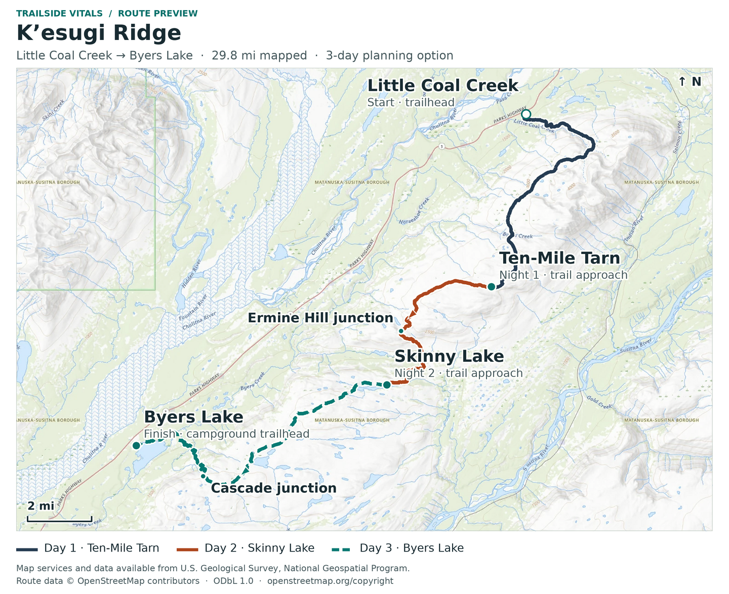


K’esugi Ridge offers a sustained journey above the forest, with rolling alpine ground, small glacially scoured lakes and a changing view across the valley toward the Alaska Range. Denali views depend on the weather; cloud can hide the mountains and the route.
DNR describes this as challenging country requiring map-and-compass competence and a willingness to turn around or wait out poor weather. Be ready to navigate independently and leave flexibility in your pickup plan.
Route identity, metrics and variants
The North map labels Little Coal Creek Trailhead at Parks Highway mile 163.9, the 3.3-mile Little Coal Creek access trail, a 10.8-mile ridge section to the Ermine Hill junction, and Ermine Hill Trailhead at mile 156.5. Ermine Hill's 3.7-mile access trail is a different entry/exit, not a compulsory detour on this traverse. The South guide gives 11.2 miles between the Ermine Hill and Cascade junctions, 2 miles for Cascade Trail, and a 5.3-mile Byers Lake loop. Do not insert the entire lake loop or Ermine Hill spur into the selected route. These are published segment definitions, not apportioned days.
The South map visibly distinguishes the Cascade descent from continuation toward Tarn Point / Upper Troublesome Creek and labels the different approaches around Byers Lake. The 2017 panel describes Cascade as 3.5 miles from the campground to the ridge, whereas the system guide's 2-mile Cascade segment starts at the lake-loop junction; the campground approach is additional. Keep the start/end scope attached to each metric rather than calling these interchangeable distances. No complete ascent/descent total is published here: the North guide gives Little Coal Creek gain as 1,750 feet, while the older park brochure/panel gives 2,200 feet. Those figures are not averaged or added into a new profile.
Finish at Byers Lake, not K’esugi Ken. The panel identifies K’esugi Ken Campground at mile 135.4 and its Curry Ridge Trail to an alpine lake, separately from Byers Lake at mile 147 and the K’esugi Ridge/Cascade system. The map shows the campground and Curry Ridge visitor area, but no verified extension from this traverse to K’esugi Ken. A 37-mile Little Coal Creek–Upper Troublesome Creek option in the guides/panel also has a different endpoint and is separate from both K’esugi Ken and the Byers Lake traverse. No extension distance or connecting permission is inferred.