

Follow New Hampshire’s Presidential ridgeline through rocky alpine terrain and broad views, with Mount Washington as a highlight. This hut-to-hut version pairs demanding mountain days with nights at Madison Spring, Lakes of the Clouds and Mizpah Spring.
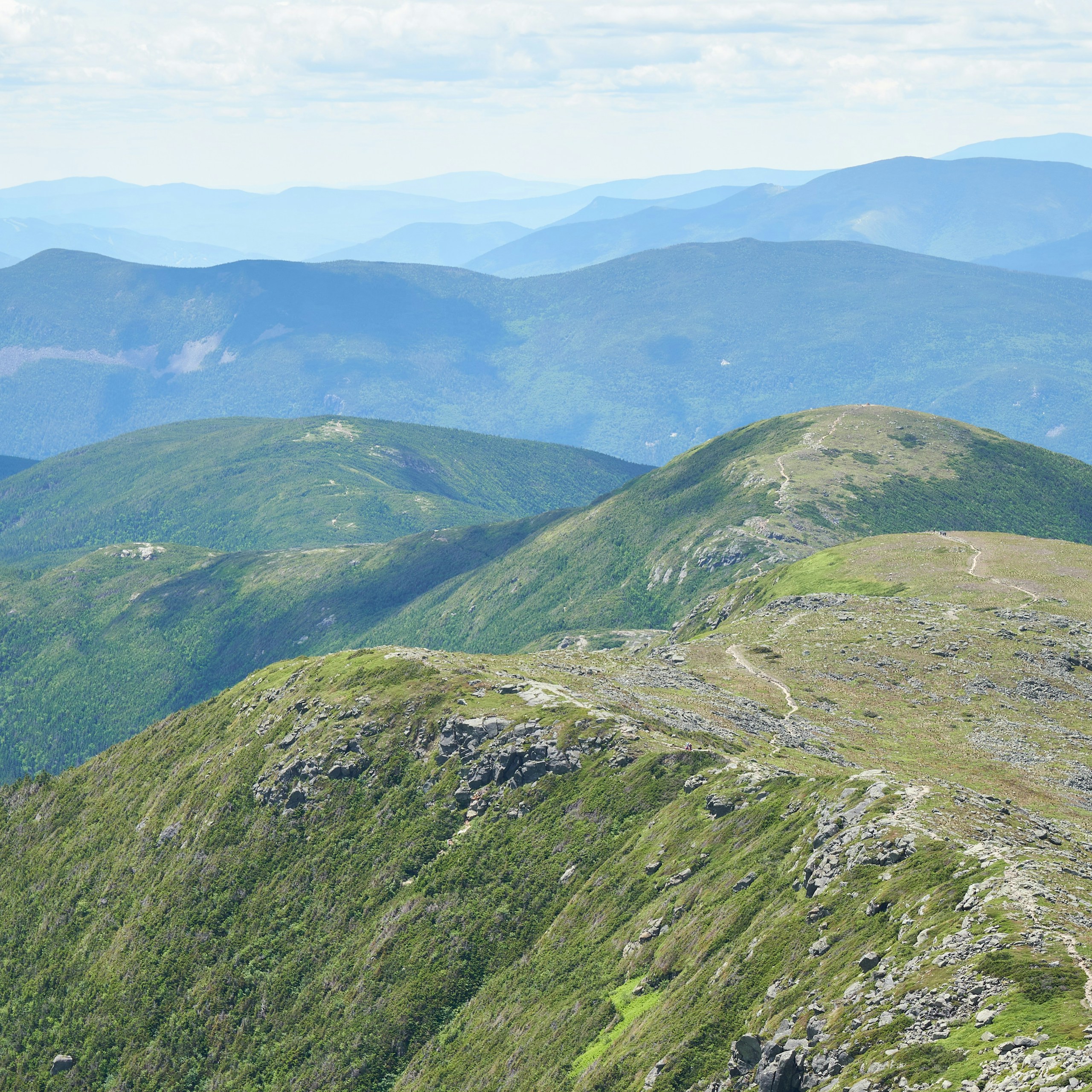
Presidential Traverse
Location: White Mountains, New Hampshire
Cross New Hampshire’s Presidential Range on a four-day hut-to-hut traverse, linking exposed ridgelines, Mount Washington and three mountain huts.
Essential facts
- Challenge
- Strenuous
- Planning duration
- 4 days / 3 hut nights
- Route distance
- 19.6 mi GPX-derived horizontal estimate (not official). Variant: Presidential Traverse | Full trip | Planning.
Overview
At a glance
- Total elevation gain
- 8,999 ft
- Cost & booking summary
- Reserve three hut nights at per-person, per-night rates; 2027 rates and service dates need confirmation. The 2026 one-way AMC shuttle was $20 member / $24 non-member; that season has ended. Travel, food and staging nights are separate.
Route & getting there
Route map & GPX
Presidential Traverse | Full trip | Planning
Overnight markers derive from the supplied daily track endpoints and may indicate a trail or camping-area approach, not a tent pad.
Plan and day selection update the route, markers, notes, and download together.
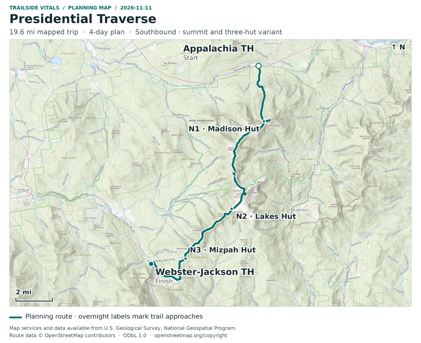
Map loading. GPX downloads are available below.
Map data © OpenStreetMap contributors. Open Database License (ODbL) 1.0.
Route sources, alignment, access and conditions notes
Dated access and conditions note (November 11, 2026)
AMC huts operate seasonally and require reservations; do not treat a closed hut as a reserved shelter. This is a normal hiking-season route, not a winter Presidential traverse. Above-treeline weather, snow and exposure can require abandoning summit loops or the whole traverse. A weather bypass would be a separately named variant and has not been silently substituted. The trailheads are Appalachia/Valley Way and Webster-Jackson on US 302, not the Highland Center itself.
Searchable points
WGS 84 latitude, longitude. Decimal places do not imply survey accuracy.
44.3715201, -71.2893343 | Appalachia / Valley Way trailhead | on mapped trail; reference offset 45 m
44.3288136, -71.2766680 | Mount Madison summit | on mapped trail; reference offset 2 m
44.3277934, -71.2833078 | Madison Spring Hut approach | on mapped trail; reference offset 11 m
44.3205994, -71.2916125 | Mount Adams summit | on mapped trail; reference offset 3 m
44.3042703, -71.3164637 | Mount Jefferson summit | on mapped trail; reference offset 23 m
44.2858725, -71.3157407 | Mount Clay summit | on mapped trail; reference offset 5 m
44.2704838, -71.3033208 | Mount Washington summit | on mapped trail; reference offset 2 m
44.2587227, -71.3189035 | Lakes of the Clouds Hut approach | on mapped trail; reference offset 11 m
44.2550697, -71.3213980 | Mount Monroe summit | on mapped trail; reference offset 8 m
44.2406659, -71.3503050 | Mount Eisenhower summit | on mapped trail; reference offset 8 m
44.2268501, -71.3657439 | Mount Pierce summit | on mapped trail; reference offset 2 m
44.2194117, -71.3697185 | Mizpah Spring Hut approach | on mapped trail; reference offset 17 m
44.2031805, -71.3754677 | Mount Jackson summit | on mapped trail; reference offset 1 m
44.2152325, -71.4077264 | Webster-Jackson / US 302 trailhead | on mapped trail; reference offset 11 m
44.3277934, -71.2833078 | Night 1: Madison Spring Hut approach | cumulative 4.18 mi
44.2587227, -71.3189035 | Night 2: Lakes of the Clouds Hut approach | cumulative 11.29 mi
44.2194117, -71.3697185 | Night 3: Mizpah Spring Hut approach | cumulative 15.88 mi
Hut/shelter reference points (not added as artificial track connectors):
44.3277897, -71.2831709 | Madison Spring Hut building reference
44.2587984, -71.3189918 | Lakes of the Clouds Hut building reference
44.2194165, -71.3695027 | Mizpah Spring Hut building reference
Appalachia Trailhead access – Trailhead
Approximate location – not an exact point. Check the source before travelling.
Reservations & costs
Preparation
- Season & conditions
- Aim for the huts’ summer full-service season, generally June through September. Check each hut’s dates and the mountain forecast before setting out.
- Technical requirements
- AMC gives a route-dependent range of 19–23 miles and about 9,000 feet of ascent. Expect rough footing, long stretches above treeline and rapidly changing weather.
Recommended gearExplore our trekking gear recommendations
For the approved three-hut-night plan, carry your own walking kit and confirm bedding, meals and personal sleep items. Do not assume a guided package or luggage transfer; a tent is not part of this hut itinerary.
Sources & references
General adventure information
- The presidential traverse itinerary (outdoors.org)
- Huts (outdoors.org)
- Shuttle (outdoors.org)
- Appalachia trailhead (gorhamnhoutdoors.com)
- Query (apps.fs.usda.gov)
Planning options sources
Planning options use the general references above.