

Trailside VitalsExplore
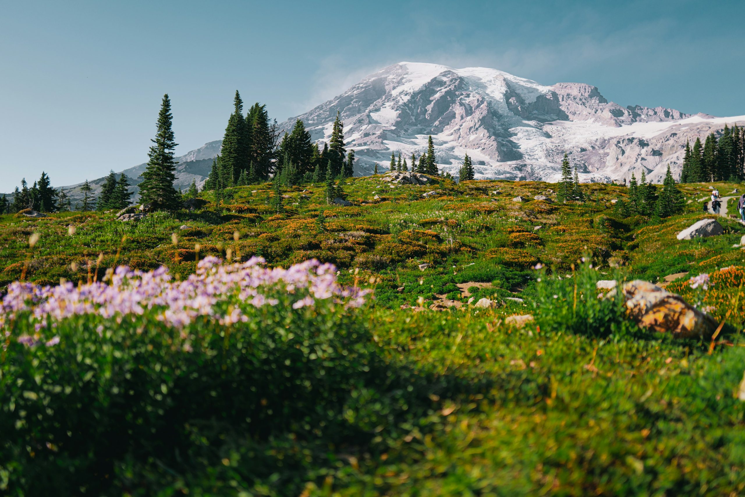
Snow-covered Mount Rainier rises above evergreen trees and a meadow of purple wildflowers.

Wonderland Trail

Location: Washington — Mount Rainier

Complete a 93-mile circuit around Mount Rainier through forests, meadows, and glacial valleys.

Essential facts

Challenge
Strenuous
Planning duration
10–14 days
Route distance
93.0 mi

Overview

Circle Mount Rainier through forests, river valleys and high meadows. Descend to rivers, climb back toward the mountain and move camp around the full circuit. Choose camps and food carries that leave enough recovery time for your group.

This is an endurance goal for experienced backpackers, even across two weeks. NPS stresses that 93 miles on flat terrain is not equivalent to repeatedly climbing thousands of feet with a full pack. Good preparation includes loaded climbs, long descents, foot care, wet-weather camp routines and enough margin to stop before conditions become unsafe. A slower headline duration does not neutralize hazardous water, lingering snow or a badly spaced permit.

Highlights include the mountain's changing aspects, linked ecological zones and a genuinely self-contained circuit. Avoid promises of clear summit views, dry camps, open bridges or guaranteed wildflowers. No summit climb or glacier travel is included in this adventure; those introduce different permissions, technical requirements and fees.

At a glance

Cost & booking summary
2026 wilderness camping: $12/person/night, age 15 and under free, plus $6/application or reservation; successful early-access applicants do not pay that fee twice. Recheck 2027. Entrance, caches, postage and travel are separate.

See dated prices & planning options

Prices, access, entry and operating details below are dated research, not live availability or a booking guarantee.

Before you book or set out

  • Camps: A year-round permit and connected designated camps are required. No cross-country camps or placeholder bookings; maximum thirteen nights/fourteen days. Groups of six to twelve need designated group sites.
  • Activation: Holder must activate in person with ID, emergency contact and overnight vehicle details, from the day before. Arrange late arrival in advance or risk cancellation at noon on the start date.
  • Conditions: Snow, washed-out bridges and hazardous rivers can prevent travel even in the usual mid-July-October window. Early travel can need expert navigation, self-arrest and fording skills.
  • Caches and storage: No current Mowich food caching under the road closure. Arrange Longmire/White River caches separately; park staff do not courier them around the circuit. Secure food/scented items on bear poles or in approved canisters; no fires, pets or bicycles.
Route alternatives, season & research details

Variants, camp network and season

NPS says the trail is typically mostly snow-free mid-July–October, but in an average snow year advises against a normal hike before mid- to late July. Earlier travel can require expert navigation, ice-axe self-arrest and dangerous river-fording skills. The permit reservation season is not a guarantee of hiking conditions. Rainier's river crossings can wash out, and autumn/winter log bridges may not be replaced until the following spring/summer. Check dated reports and rangers, not a calendar alone.

The official page lists eighteen trailside wilderness camps and three non-wilderness camps. Candidate sectors clockwise from Longmire include Pyramid Creek/Devil's Dream, the Puyallup camps, Golden Lakes/South Mowich, the Carbon/Mystic/Granite Creek area, Sunrise/White River, Summerland/Indian Bar and Nickel Creek/Maple Creek/Paradise River. These are options from the source's camp list, not an instruction to sleep at all of them or an allocated ten-day sequence.

Spray Park is an alternate route, with Eagle's Roost and Cataract Valley camps; do not combine its camps or measurements with the standard route without naming the variation. Longmire has no wilderness or non-wilderness camping. Cougar Rock is a separate developed campground booking through Recreation.gov, not a substitute wilderness reservation. Groups of six to twelve need designated group sites, which some camps lack.

Route & getting there

Arrival, transport, overnight choices and food caches

Longmire access begins at the stone steps opposite the Wilderness Information Center lawn; NPS describes a short connecting spur to the circuit. Starting and finishing there can avoid a point-to-point trailhead transfer, but food-cache placement remains a separate transport problem. The park explicitly does not courier visitors' caches around the circuit or provide a cache-placement shuttle.

Use the current cache instructions for Longmire and White River Campground. Because the Fairfax Bridge closure cuts access to Carbon River/Mowich Lake, no Mowich food caching is currently allowed. Do not recycle an older “three easy resupplies” itinerary. The closure affects road access; it does not establish that the walking circuit is closed. Check trail reports separately.

Use clearly labelled rodent-resistant plastic containers with permit-holder name, collection location/date and permit number. The page limits each group to five five-gallon containers per location. Mail in time to arrive at least two weeks early or hand-deliver; unused caches are not returned. Longmire accepts UPS/FedEx, not USPS. White River caches are mailed to its WIC and delivered by rangers to the campground; collection is not at the distant WIC. Fuel cannot be mailed, is kept separately at Longmire, and cannot be cached to Mowich under the present closure.

Allow a separate arrival day to activate the permit, place caches and confirm access. National Park Inn is an optional Longmire-area accommodation/dining prospect, not a camp on the circuit. Rates, rooms, baggage storage, cache handling by the hotel and transfers remain unverified.

Route map & GPX

Wonderland Trail | Full trip | Planning

Overnight markers derive from the supplied daily track endpoints and may indicate a trail or camping-area approach, not a tent pad.

Plan and day selection update the route, markers, notes, and download together.

Complete-route map preview for Wonderland Trail
Complete-route preview

Map loading. GPX downloads are available below.

Download complete-route GPX

Map data © OpenStreetMap contributors. Open Database License (ODbL) 1.0.

Route sources, alignment, access and conditions notes

Dated access and conditions note

Planning route only; check current land-manager conditions before travel.

Longmire Wonderland access area – proposed loop start – Trailhead

Approximate location – not an exact point. Check the source before travelling.

Open location on OpenStreetMap (external map)

Reservations & costs

Connected designated camps

A year-round permit and a connected camp sequence are required; early access is not a guaranteed circuit.

More about Connected designated camps

A year-round wilderness permit is required. Complete Wonderland hikers must use designated camps, not cross-country zones. Roughly two thirds of summer inventory is advance-reservable, and one third walk-up. A full connected circuit can be hard to assemble after early access; neither an access-window lottery win nor a first-come allocation guarantees the desired route.

Release-calendar qualification

No exact 2027 lottery window was verified; current process guidance and older infographics are not a new announcement.

More about Release-calendar qualification

The current NPS process describes a February early-access lottery, individual March–April reservation windows, and April 25 general on-sale. It links an older 2025 infographic and warns users to check Recreation.gov for exact dates. No exact 2027 early-access lottery window was verified here. Use this as a process overview and check the actual release dates before booking. The separate conditions page does publish a 2027 permit-office operating period; that is not the same as announcing the lottery.

Activate the reservation

Collect and activate with required documents; arrange late arrival rather than missing the noon start-day deadline.

More about Activate the reservation

Reservations generally require at least two days' lead time; walk-ups are issued on the start day or the day before. The reservation holder must visit a ranger station to activate the permit with photo ID, emergency contact and overnight vehicle details. A reservation is cancelled if the holder does not arrive by noon on the start day, unless late arrival was arranged in advance. Collection can begin the day before, not earlier.

Trip and stage limits

Maximum nights and online mileage caps are booking rules, not a safe pace recommendation. Do not reserve placeholder camps.

More about Trip and stage limits

The source limits a trip to 13 consecutive nights/14 days. Online booking limits stages to 17.5 trail miles; longer requests need the park's separate process and are not an endorsement of that effort. Changing the start date requires cancellation/rebooking. Do not book placeholder camps with an intention to ignore them.

Lottery/reservation

Application/reservation fee is not paid twice by successful early-access applicants.

Basis
$6/application or reservation, non-refundable
Inclusions/exclusions
Successful early-access applicants do not pay an additional reservation fee; walk-ups also pay $6.

Wilderness camping

Explicit 2026 per-person nightly camping basis; recheck 2027.

Basis
$12/person/night; age 15 and under free
Inclusions/exclusions
Explicit 2026 NPS FAQ confirmation; not a flat trip fee.

Borrowed bear canister

Free canister borrowing needs capacity and stock confirmation.

Basis
Free at WIC, availability to confirm
Inclusions/exclusions
Not purchased equipment or automatic allocation.

Postage, cache containers/delivery, entrance, lodging, transport

Cache delivery, entrance, lodging and travel are extra.

Basis
Actual quotes/current entrance fee required
Inclusions/exclusions
Not included in the wilderness fee; budget these separately.

Price date & basis

USD, checked 2026-10-30; 2026/current posted fee structure, not a 2027 price guarantee.

Preparation

Preparation, equipment and water

Carry water treatment and assess sources with rangers for the selected camps and exposed sections. A glacial river is not automatically a safe crossing or accessible drinking-water source. The conditions page recommends early-day crossings when water tends to be lower, but does not make any crossing safe or require pushing through a hazardous ford. Turnaround and authorized rerouting remain necessary options.

Food, garbage and scented items in designated camps must be secured on bear poles or in approved animal-resistant canisters; NPS offers free canister borrowing at WICs. Confirm availability and capacity. Include waterproof shelter, insulation, stove, navigation and emergency communication, plus enough food to cope with the actual cache plan. Fires, pets and bicycles are prohibited in the wilderness.

Sources & references

General adventure information

Article research and source-date qualifications

Planning options sources

Planning options use the general references above.